Finally, time to make the final leg in this marathon journey. Though I was glad to get home, I was none-the-less sorry to see the trip end. I sure experienced and saw so much that I could never begin to show it all in photos. In addition, I did not realize how tired I was. I pretty much was a zombie yesterday (Monday) as I was finally able to relax and not have to get up at 6:00 and realize I had another 450 to 500 miles ahead of me. Well, let's get going!
As I am somewhat of a railroad fan, I decided to take one final detour before I made it home, and that was to the Horseshoe Curve near Altoona, PA. This was about an hour out of my way, so no big deal, plus it was down a narrow twisty road, which I loved! There is a museum and a funicular there, but they did not open til later, so, unfortunately, my view-point of the curve was not so great. Here are a couple view that I was able to get.
This is the tunnel under the curve you have to pass through to get to the vantage point.
Just as I was leaving, waiting for the light to change to let me get through the one-way tunnel, I heard the unmistakeable sound of diesel engines struggling under the load. Unfortunately, my vantage point was not great, but I was able to get a couple pics of the Norfolk-Southern freight train as it rounded the curve. I believe there were 3 engines in front and 4 in the rear. Quite an impressive sight and sound!
Like I said, my vantage point sucked! Anyway, I got to see a train on the curve!
So, it was then off to home, and the final tally:
As I posted on my S2000 Forums, here is my summary of the trip:
Miles: 6,924.7
States: DE, MD, WV, OH, KY, IN, IL, MO, KS, CO, UT, NV, OR, ID, MT, ND, MN, WI, MI, PA (That's 20)
Provinces: AL, SK, MB (That's 3)
Days: 20
Gas Burned: Who knows??? Many, many gallons and litres
Bottles of Bombay Sapphire Consumed: 2, I think
National Parks Visited: 4
National Monuments Visited: 2
International Parks Visited: 1
New Soft Top: 1 (Thanks, Hardtopguy!)
Top Speed per Garmin: 109 MPH, but I think that's a GPS error
Amount of Fun Experienced: Impossible to count!
Thanks for riding along with me! There may be other trips on the horizon. Who knows! :)
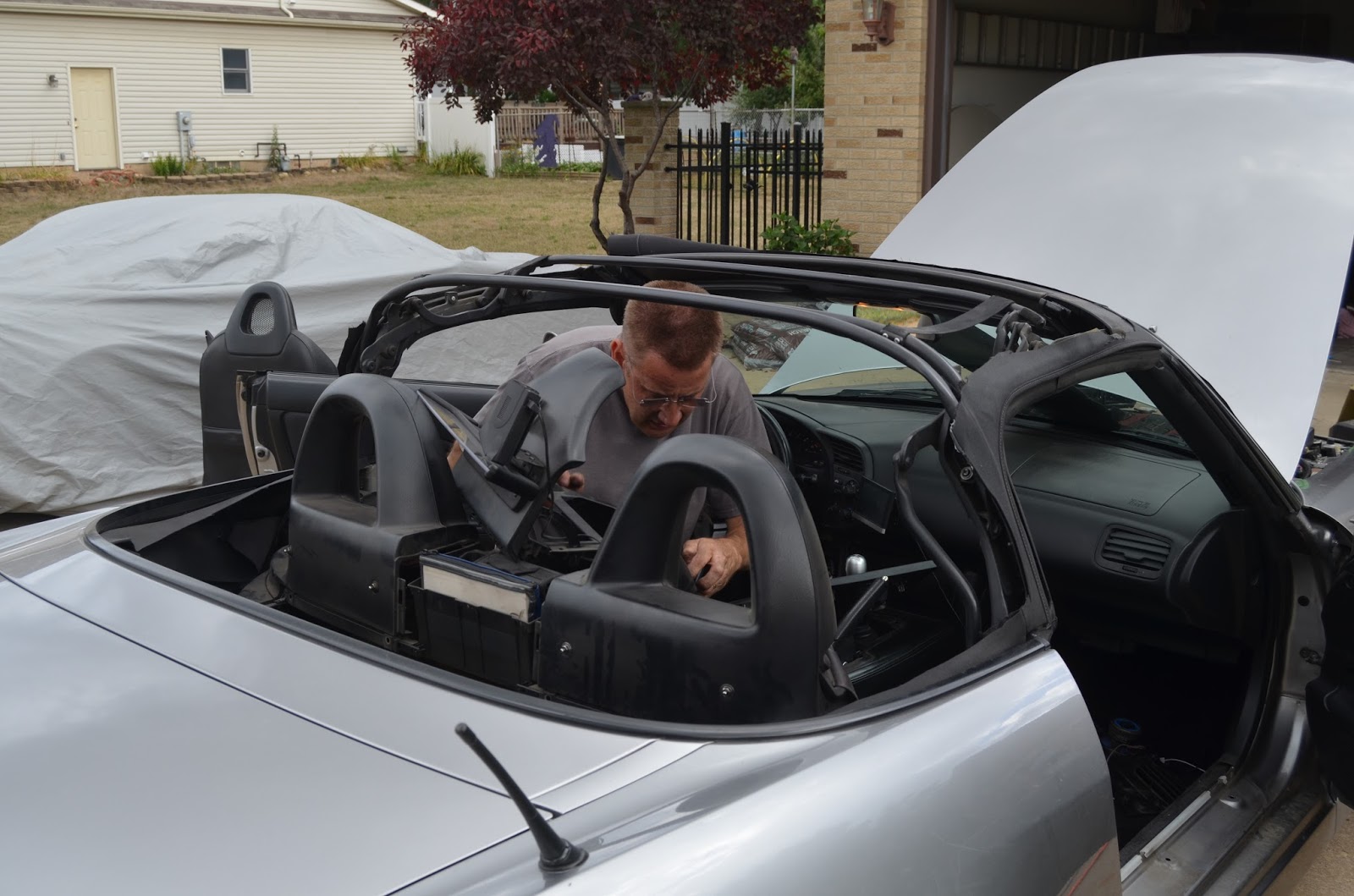
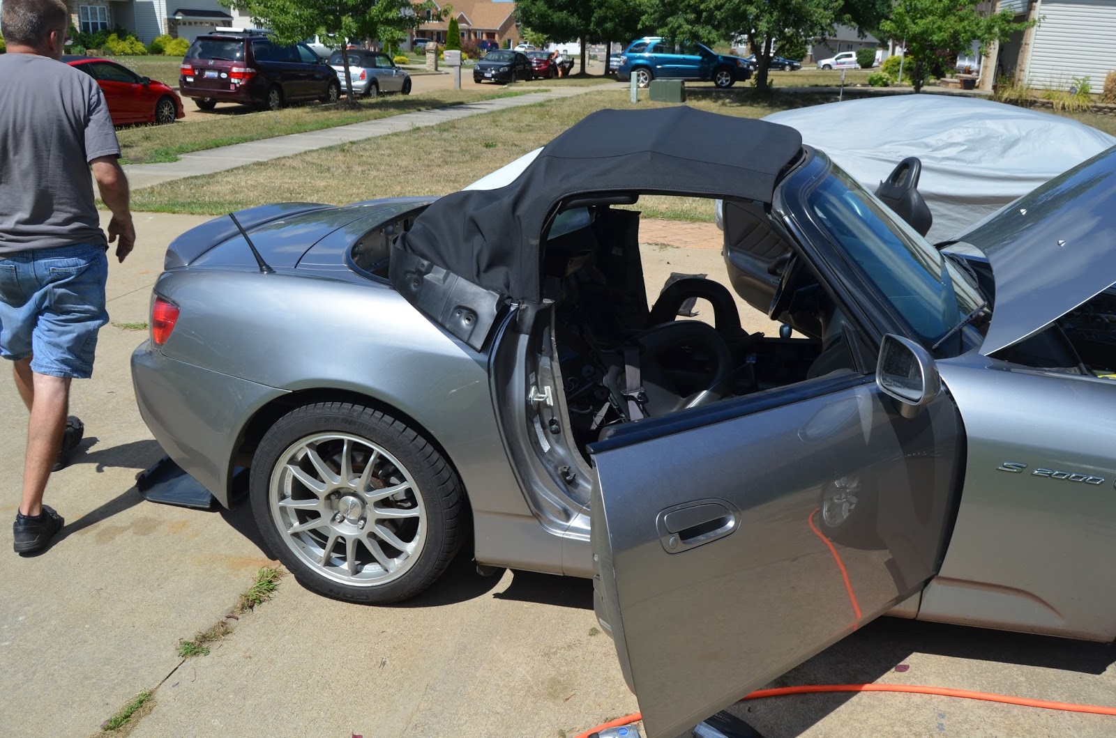
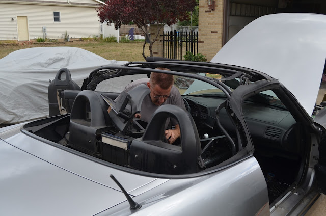
Now that I have some time, I would like to complete the blog. This was on Saturday, August 6, and it involved about a 1 3/4 hour trip from near Toledo to my friend Jeff's house near Cleveland to get a new soft-top installed. The original one on the S was 15 years old, and had developed several pin holes, and even worse, some substantial tears that could not be repaired. In addition, the plastic rear window was badly fogged to the point that it was difficult to see out. Jeff sells Honda and Acura parts on-line, and is an experienced installer, so as it worked out, I was able to arrange my trip to be at his house early Saturday morning for the top install. I was surprised to learn that the interior of the car had to be pretty much completely disassembled to get at all the parts necessary to remove the old top and install the new one. These pics are in order of the removal and installation: WARNING - CAR PICS - Feel free to skip this day's blog if these are boring!


All done! What a pleasure to have a nice, new top. Ready for another 15 years. :)
In addition, when I had the oil changed in Medicine Hat, they told me my engine and cabin air filters were dirty, so I had Jeff get me new ones. These are the old ones:
I would say they needed replacement!
So, day 19 was a complete car guy's day. After the top install, it was on to Cranberry Township, PA, just off the PA Turnpike, northwest of Pittsburgh.
Unlike yesterday, today was a top-down day! The first 85 miles or so were through the Upper Peninsula of Michigan (the UP, or as the locals are known: Yoopers) The road, US2, is mostly bordered by woods, and I met and passed numerous logging trucks. Soon, however, it was time to cross Lake Michigan, via the Mackinac Bridge ($4.00 toll)
But, first, the obligatory Garmin guess:
The bridge, from a tourist trap:
Some 250 miles later, I stopped at my S2000 friends' Dave and Donna's house in Jackson, and enjoyed a brief visit with them. Though he no longer owns an S, he is an avid MGA restorer and has an immaculate garage and collection that I could only begin to capture in these pics:
He compiled and edited this massive book about the Michigan MG Club. Impressive!
This is a man's cave man's cave, complete with beer fridge and all that goes with it!
His wife is an avid gardener, and was only too happy to show off her flower gardens:
They have a beautiful place, but unfortunately, I could only spend a short time there, and after they treated me to lunch at a local pub, it was time to go to my overnight spot in Maumee, OH, near Toledo. Tomorrow, I will be heading another friend's place near Cleveland to have him install a new soft-top on my S. The 15-year old one is in sad shape, with tears and pin-holes, plus the rear window is badly faded. I'll try to take pics of the installation.
Today's final Garmin reading:
This epic journey is nearing its end, and even though I've enjoyed every minute, I'll sure be glad to pull into my driveway back in Delaware!
This will be a quick update, because today was overcast and threatening, with light rain falling all afternoon, so the top stayed up all day. We had a very strong thunderstorm last night that woke me up, and it was apparently associated with tornados that struck Devils Lake, North Dakota, where I passed through yesterday! In fact, I saw a Tornado Chaser vehicle somewhere on the road yesterday, heading west, so I guess they knew what was coming. Glad the tornados didn't make it to Minnesota! I have been really fortunate, weather wise for this trip. Every day, except for today, has been perfectly clear, with great top down weather. I have the tan to prove it. :} I did have the occasional sprinkle that caused me to briefly put the top up, but over all, there were only 3 nights when I was awakened with a passing thunderstorm.
On to today. As usual, I asked Garmin to tell me what to expect:
Forgot to add a couple pics. The headwaters of the Mississippi are near here, but I did not go there. But, the river flows through Grand Rapids, and it's a bit narrower than it is down-stream, say, in St. Louis. So, before I left, I took these pics:
This was a statue in the park beside the river bridge.
For some reason, Minnesota and Wisconsin make it impossible to take a photo of their state sign with your car, so I have no photographic proof that I was in those states, but, trust me, I was!.
Today was my first sighting of Lake Superior at Duluth, and it was quite imposing to see what is now called the rust belt of the US. Unfortunately, no pics. Michigan, however, was welcoming, though I had to park near inches off a merge ramp to get these pics:
What, exactly, is "Pure Michigan," though?
Anyway, I am on the north shore of Lake Michigan on the Upper Peninsula, and was able to grab a couple pics of the lake. Quite impressive with the on shore breeze.
I didn't realize the Big Boy chain was still around, but guess it is:
And today's final GPS reading:
Tomorrow, I'm off to Toledo, with a lunch and beer stop at DLQ Dave's. It'll be good to see him and Donna!
This was also a long day, which involved crossing back into the US. I must say that the Canadian Border Guards are much more pleasant to deal with than ours. Today yielded some pleasant surprises, but first, the GPS reading, which, for the second day in a row, I agreed to follow its guidance.
Note that it's back in American-speak since we will be ending in the States. :)
At the border, I had noticed a little note on my AAA maps: International Peace Garden. WELL. So glad I took this route. The following are a whole bunch of photos of this phenomenal place, which should particularly be of interest to my gardener friends: Bea and Sharyn, and my photo friends, Lainey and Patty. I'm sure the 4 of you (and others, could have easily spent hours and hours exploring these grounds, but I just didn't have the time!) I apologize for any duplicate photos.
Sadly, the monument pictured above is deteriorating, and will soon have to be destroyed, as noted in these pics:
So, after leaving the Peace Garden, it was on to North Dakota, the third in my bucket list state:
While not the world's largest ball of string, I found that the Geographical Center of North America was interesting, and someone even volunteered to take my ugly mug in Rugby, ND:
The next state on my bucket list is the one I'm in now, Minnesota, however the state-line marker on a bridge above the road so I was unable to get a photo as I quickly passed under. I'll try to find a remedy tomorrow, as well as a photo of the headwaters of the Mississippi, as I continue on my journey!
Ending GPS photo tells today's tale: